Elevation of Seekirchen am Wallersee, Salzburg, Austria
Seekirchen am Wallersee, Salzburg, Austria is 517 m (1,696 ft) above sea level.
Seekirchen am Wallersee's height from sea level is 517 metres, or 1,696 feet. GeoNames reads 510 m at the same point (SRTM); Wikidata records 512 m.
Also written: Seekirchen Markt Seekirchen.
Ground within 4 km
Mean 556 m across the 8.5 km square centred on the town, 132 m from its lowest cell to its highest.
Cross-section through Seekirchen am Wallersee
Ground elevation along two lines through the town, 24 km end to end, one cell (about 1 km) per step. The red dot is Seekirchen am Wallersee; the vertical scale is the same on both.
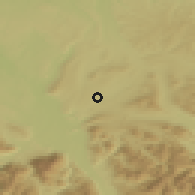
Shading is a north-west light over the grid's own slopes. Colour follows elevation: sea level and below, 0–200 m, 500 m, 1,000 m, 2,000 m, 3,500 m, 5,000 m and above.
Towns near Seekirchen am Wallersee
| Town | Distance | Direction | Elevation | Compared |
|---|---|---|---|---|
| Eugendorf | 3 km | S | 545 m (1,788 ft) | +28 m |
| Henndorf am Wallersee | 4.9 km | E | 560 m (1,837 ft) | +43 m |
| Elixhausen | 5 km | SW | 534 m (1,752 ft) | +17 m |
| Hallwang | 5.6 km | SW | 502 m (1,647 ft) | −15 m |
| Obertrum am See | 5.7 km | NW | 507 m (1,663 ft) | −10 m |
Peaks and passes near Seekirchen am Wallersee
- B'gadener Hochthron, peak at 1,972 m (6,470 ft), 24.3 km to the SW — 1,455 m above the town.
- Berchtesgadener Hochthron, peak at 1,972 m (6,470 ft), 24.6 km to the SW — 1,455 m above the town.
- Salzburger Hochthron, peak at 1,853 m (6,079 ft), 21.5 km to the SW — 1,336 m above the town.
- Schellenbergsattel, pass at 1,439 m (4,721 ft), 20.8 km to the S.
Summit heights from GeoNames (CC BY 4.0), within 25 km; only summits higher than the town are listed.
Where Seekirchen am Wallersee is
Latitude 47.89535, longitude 13.12104. Open the map here to read the elevation of any point around the town.
Put this on your site

A small badge with the town's elevation, linking back here. The number updates if the grid reading ever changes.
About this reading
The elevation is the value of the GMTED2010 terrain grid (USGS/NGA, 30 arc-second cells of about 1 km) at Seekirchen am Wallersee's recorded coordinates. It is the height of the ground in that cell, not of any building; a town on a slope spans several cells, and the range above says how much that matters here. GeoNames' reading of 510 m comes from a finer 90 m SRTM grid at the point it records for the town, which may sit a few hundred metres from ours; the two agreeing to within a few metres is the usual case on flat ground, and a larger gap means the ground is steep. Wikidata's figure is the one its editors cite for the town, often from a survey marker or the town hall.